")
")
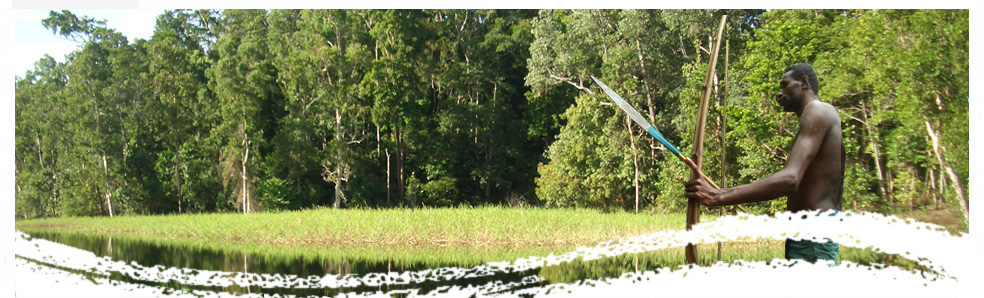
 Although the level of deforestation in the world's second-largest tropical forest remains relatively low compared to similar regions in Asia and Latin America, the latest satellite-based monitoring data has revealed that the annual rates of gross deforestation in the Congo Basin have doubled since 1990, according to a new study. The report, State of the Forest, is the most recent comprehensive assessment of forest cover in the six-nation Congo Basin, Central Africa. It cites population growth, immigration, economic development and global demand for natural resources as the major pressures on the forests.
While the report says the evaluation of threats to forests remains a delicate exercise with many uncertainties it lists five primary drivers of deforestation: fuel wood extraction, agriculture, mining and oil extraction, expansion of biofuels and logging.
And although countries of the region have launched initiatives to preserve their economic resources, protect biodiversity and the creation of protected areas, results have not lived up to expectations nor do they satisfactorily reflect investments to date.
The 274-page report says the forest cover change estimates are of critical importance for Central African policymakers as well as for a UN climate change mechanism known as REDD+ (Reducing Emissions from Deforestation and Forest Degradation), which could see developed countries contribute significant funding to developing ones to safeguard their forests.
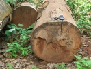
Although the State of the Forest report lists logging as one of the five primary direct threats to forest cover, the report emphasises that log production in the formal sector - which has been negatively affected by a steep drop in demand due to the 2007-2008 global economic downturn - accounts for just 3 percent of global tropical timber production, far behind Latin America and the Asia-Pacific region.
But research conducted by the Center for International Forestry Research (CIFOR), based on a systematic appraisal of the economic and social impacts of chainsaw milling in the Congo Basin - the informal lumber sector - indicates it is much more important than suggested in regulatory frameworks and official data.
Researchers found that little attention has been paid to the sector across the region, even though it has been moving ahead of industrial production and exports of sawn timber. In Cameroon, for example, domestic consumption rose to 860,000 cubic meters of sawn wood in 2009 while sawn wood exports declined to 343,000 cubic meters.
The reported timber volumes and the social dynamics behind the informal timber sector call for its long-awaited acknowledgement by policy makers and its better integration in current and future forest policies said Robert Nasi, a CIFOR Director and co-author of the report.
State of the Forest, the third in a bi-annual series of reports on the Congo Basin forest region, is the first to base its indicators and estimates on a vast amount of satellite images acquired over the last two decades.
Prior to the mid-1990s, the understanding of forest change in the Congo Basin, which remains for the most part a notoriously difficult region for researchers to access, was largely based on patchy and anecdotal information without spatially explicit delineation on forests or statistically robust estimates of forest cover change. And the lack of accurate, up-to-date information on the current state and evolution of Central Africa's forested areas has been seen as a major factor limiting the design of efficient forest management policies.
But thanks to the latest mapping technology that took advantage of much more recent satellite time series the State of the Forest has produced a new forest map that consistently covers the six Congo Basin countries plus Rwanda and Burundi. The production of the map relied on a semi-automatic method that combined statistical classification, expert consultation and manual editing.
For the first time 20 classes of land cover ranging from dense moist forest to mosaic of cultivated land and natural vegetation were mapped for the Congo Basin at a 300-meter resolution. And because of the increased availability of satellite images, including almost 3,000 daily SPOT-VGT observations, the quality of the mapping of the state of tropical forest degradation in the countries bordering the Atlantic Ocean has been greatly enhanced.
Results of the forest change sampling method based on an approach that covers four forest change processes - deforestation, degradation, reforestation and regeneration - estimated a gross deforestation annual rate of 0.13 percent for the period 1990-2000; the rated doubled to 0.26 percent for the period 2000-2005. The highest gross deforestation rates occurred in the Democratic Republic of Congo, Cameroon and the Republic of Congo, while deforestation rates actually stabilized in Gabon and the Central African Republic. Analysis is on-going to determine deforestation rates for the period 2005-2010.